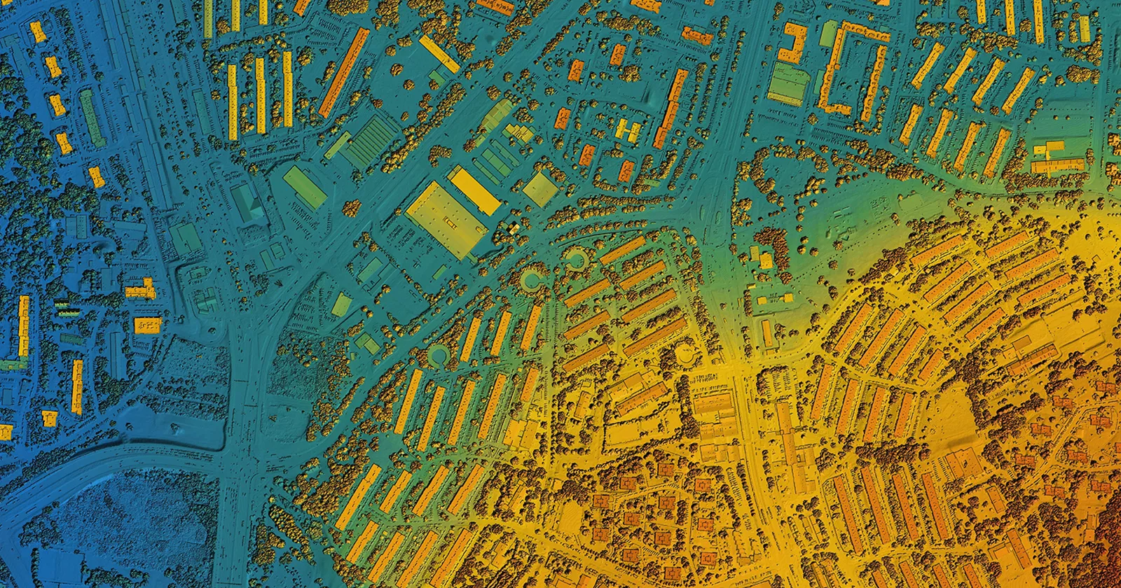
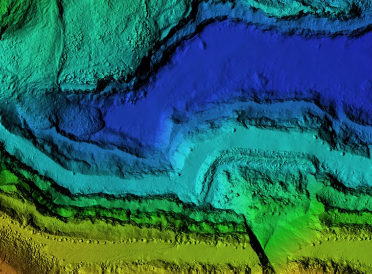
How does Exponent leverage geographic analytical tools to demonstrate site analysis for clients involved in site exploration, accident investigations, or legal disputes?
Clients come to Exponent to better understand the topography of an area or to further explore an ecological or environmental issue affecting their land or job site. Our teams use a variety of cutting-edge monitoring and analysis tools, including GIS technology and other remote sensing tools, to evaluate important spatial orientation data, demonstrate changes in a site over time, and provide enhanced context that helps stakeholders make informed decisions.
GIS is one of several powerful analytical tools used to characterize and study spatial relationships through data layering. This tool provides important insights regarding soil chemistry, ecological relationships, site geology, historical land use, time-series data, and trend analysis.
Exponent's multidisciplinary teams of engineers, chemists, geologists, toxicologists, and biologists work with outputs from mathematical and statistical models to assist with trend and forensic analysis and to offer insights into problem causation and possible solutions. These tools provide visual data evaluations critical to the success of any spatial assessment and are particularly useful in providing scientific evidence in investigations involving geological and ecological disputes.
services
For 50+ years, we’ve thrived on solving unstructured problems that require bespoke solutions. Some of our services include:
• Add spatial context to complex problems using GIS, digital maps, photographs, high-resolution satellite images, GPS field data, site-specific data layers, and other emerging visual media
• Create new spatial model outputs based on historical data
• Identify and make statistical inference on clusters of diseases to ascertain whether clusters are part of a natural random process or are extraordinary and require further investigation
• Infer the likely distribution of a particular item where limited measurements are available
• Use modern machine learning methods to make use of multivariate data with potentially complex spatial structures
Our Capabilities Are Unparalleled
With expertise in over 90 disciplines and hundreds of capabilities, tools, and methodologies — we get to the root of even the most complex challenges and give you the objective answers you need.

Environmental Permitting
Extensive support for compliance with local, state, and federal permitting requirements.
![[EBS] Ecological & Biological Sciences - Environmental Risk Assessment - grey heron grazing in fresh water](/sites/default/files/styles/cards_home_card/public/media/images/grey-heron-2022-01-04-23-54-37-utc%281%29_0.jpg.webp?itok=5EB0lXjA)
Environmental Risk Assessment
Risk assessments for legacy spills and contamination, potential project and product impacts, and environmental remediation support.

Sustainability
Meet changing sustainability regulations with rigorous science and experienced consulting services.
Modeling & Analysis
Experienced environmental analysis and data modeling for a range of complex environmental challenges.
Natural Resource Damage Assessment
Multidisciplinary natural resource damage assessments (NRDAs) to support navigating complex interactions with federal, state, and tribal trustees.
Experts
Our global and comprehensive expertise across industries gives us a deep understanding of current challenges, best industry practices, and the implications of emerging technologies.


Insights